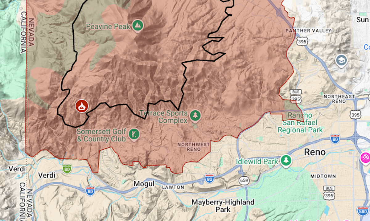
The summer’s fifth big wildfire is burning in the high desert near Reno, and its evacuation zone extends to the edge of the University of Nevada campus.
Read more Bay FC earns badly needed victory thanks to late goal
The Hawk Fire was reported shortly before noon Saturday, Aug. 22, in the hills just east of the California line. By Sunday night, it had burned more than 15,000 acres (23 square miles).
The evacuation zone covered about 75 square miles. The map above shows the evacuation area in red and the approximate perimeter as a black line.
In recent weeks, evacuations were ordered in an area just to the north for the Elephant, Bug, Fred Mountain and Stallion fires.
Read more Bay Area events calendar for Aug. 28 through Sept. 3 weekly editions
Hawk is burning principally toward the northeast; warnings are in place in California’s Sierra County but no evacuation has been ordered.
For updates and details of the evacuation, including warning areas, see the Washoe County emergency website (Nevada) or the Genasys Protect map (California).
Read more Walnut Creek eyes fleet electrification, better public EV charging program
About the Author