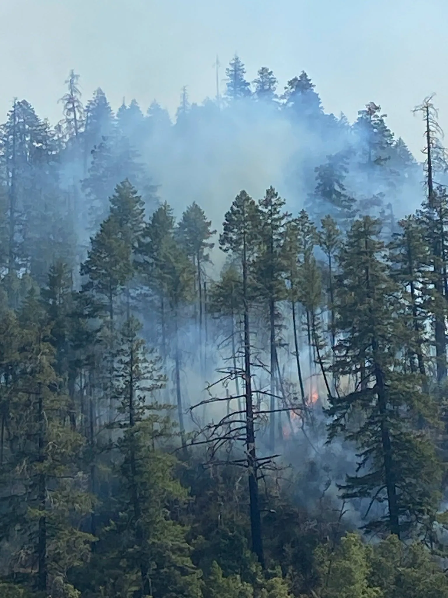
On Wednesday, the Mile Post 18 Fire, a blaze burning north of Hoopa along the east side of Highway 96, expanded to 2,803 acres. As of Wednesday morning, the fire is roughly 10% contained. 720 firefighting personnel have been dispatched to the fire, which is currently being managed by California Interagency Management Team 1.
Read more Longtime Warriors nemesis Russell Westbrook retires from NBA
An evacuation warning for zone HIA-E002-A was upgraded to an order as of Wednesday just before noon. The Humboldt County Sheriff’s Office has called for the evacuation of residents north of Mill Creek, south of Coyote Creek and Hopkins Creek, west of North Fork Mill Creek and east of Highway 96. A temporary evacuation area has been set up at the Hoopa Neighborhood Facility.
“Crews successfully held the fire east of Highway 96 and the Trinity River, quickly addressing small areas of fire that crossed established control lines,” an update published Wednesday morning reads. “On the southern portion of the incident, handcrews continued constructing handline down to Mill Creek and successfully completed firing operations to secure and hold the line.
“Active early morning fire behavior persisted on the northeastern perimeter due to heavy, dry fuels and complex terrain. Spot fires ahead of the main fire occurred along the eastern boundary, and crews will work (Wednesday) to contain them along Oil Springs Road. The incident continues to be managed under full suppression tactics with firefighter and public safety remaining the highest priority.”
Operations Section Chief Travis Thane with California Interagency Management Team 1 gave a morning video briefing, published just before 9 a.m., outlining specifically the actions that responders were undertaking.
“Crews continued to work diligently along the 96 (Tuesday) … patrolling and mopping up — real steep, rugged, challenging topography to the point where it cliffs out, and we’re having to work some of our scoop-in billygoat people in here just to mop it up as we tie it down into the Trinity River and secure this whole river corridor all along the west side (of the fire’s perimeter) … We’re looking at opportunities to put riverboats in here and mop up from the bottom and west side, but the fire continues to hold as we make progress down in the south.”
Thane described firefighters as having “a really solid anchor and toehold on the southwest portion of the blaze on a previously fire-scarred stretch near Highway 96’s Mile Post 16, and said that crews had done prophylactic burning along Mill Creek Road on the south side of the fire the previous day and were continuing to push back the progress of the fire “with really positive fire effects.”
“The burn was really successful all the way down to Mill Creek,” Thane said, noting that crews worked all day to limit the spread of fire to the Mill Creek drainage to the south.
Crews, Thane said, worked throughout the night on the east side of the fire, where spotting has occurred, and the fire “continued to burn very active through the night.” He said that crews are, as of Wednesday morning, looking to “hold and improve and look for scouting opportunities to start containing the spot fire.”
Thane said that bulldozers and helicopter crews had been active north of the fire along the “north creek ridge,” establishing a retardant line that extends from the northeast of the fire to Highway 96.
In a press release published Wednesday, PG&E noted that the utility’s Safety Infrastructure Protection crews are “supporting Cal Fire, the U.S. Forest Service and agencies responding to the MP-18 Fire in Humboldt County.”
Those crews are expected to use flame retardant on energy infrastructure around the proximity of the fire, California Interagency Management Team 1 Lead PIO Deborah Carlisi told the Times-Standard on Wednesday just before noon, but there are no structures currently under threat from the fire.
“At this time we don’t have any structures in danger,” Carlisi said. She also noted that weather experts had informed her that fire crews could expect “pretty benign” weather (despite wind and thunderstorm warnings to the south in Trinity and Northern Mendocino).
Read more OPD releases video footage of fatal mid-July police shooting in Fruitvale
“A layer of marine air will push into the Trinity River drainage, keeping temperatures in the 80s, with overnight lows in the 60s,” the management team’s Wednesday morning press release noted. “Afternoon humidity will drop to 25–30 percent; however, overnight recovery has been good, reaching between 60 to 80 percent. Winds will shift from light, downcanyon northeast at night to northwest at 5–10 mph in the afternoon and evening.”
Carlisi said that thunderstorms may affect the area by Friday.
The MP-18 Fire was initially reported on August 7, and ballooned the following day to 300 acres. It’s since grown prodigiously in the rugged and densely wooded terrain.
Level 2 evacuation warnings remained in effect for zones HIA-E003, HIA- E004, HIA-E006, HIA-E002-A and HIA-E14-C. An additional evacuation warning for zone HIA-E002-B was issued just before 2 p.m.,and Highway 96 north of Hoopa remains closed, as is portions of Hostler Ridge Road, Mill Creek Road and Big Hill Road.
An evacuation order was issued for zone HIA-E002-A just before noon.
That zone is north of Mill Creek, south of Coyote Creek and Hopkins Creek, west of North Fork Mill Creek and east of Highway 96, according to an update from the Humboldt County Sheriff’s Department.
The Hoopa Fire Department and Office of Emergency Services announced in the afternoon that a temporary evacuation point has been established.
“… The Humboldt County Sheriff’s Office has issued an EVACUATION ORDER for Zone HIA-E002-A north of Mill Creek,” that announcement reads. “If you live in this area, you must leave immediately. A temporary evacuation point has been set up at the Hoopa Neighbor (sic) Facility located at 11860 HWY 96.”
Hoopa OES also announced that it has set up cooling centers to help those forced outdoors avoid the heat. Those centers are at the Hoopa Neighborhood Facility and Senior Nutrition Center and are open from 10 a.m. to 6 p.m.
The Hoopa Valley Tribe’s Air Quality Program listed air quality in the area as moderate Wednesday morning, warning that sensitive people may experience irritation of the eyes, nose, throat and lungs and encouraging those people to “limit vigorous outdoor activity to 4-6 hours a day.”
Firefighters also warned about operating amateur drones in the area to film the fire.
“Aerial firefighting resources, such as airtankers and helicopters, fly at very low altitudes, typically just a few hundred feet above the ground and in the same airspace as drones flown by the public,” a Facebook alert published Tuesday night reads. “If an unauthorized drone is detected flying near a wildfire, fire managers may have to ground all aerial firefighting resources until they can confirm that the drone has left the area. This can cause wildfires to become larger and more costly and unduly threaten lives, property and valuable cultural and natural resources”
Up-to-date information
Go to linktr.ee/MilePost18Fire for links to fire information, evacuation warnings, air quality and road closures.
Read more Valkyries injuries present Stanford alum Fingall with unexpected birthday opportunity
Robert Schaulis can be reached at 707-441-0585.
About the Author